“Who has not felt the urge to throw a loaf of bread and a pound of tea in an old sack and jump over the back fence.” -John Muir
I sent a text to my good friend Zach on Monday night to discuss possibly going on a big hike sometime this summer. By Friday night, we were halfway through the Pemigewasset Loop, twelve hours into our first of two days of hiking what backpacker.com called the second hardest backpacking trip in the country. People typically take a few weeks or even months to plan out a hike of this magnitude, but Zach and I needed only a day or two to iron out the details, and we were off.
We got to the trailhead at the Lincoln Woods center, off of the stunning Kancamagus Highway in the White Mountains National Forest in New Hampshire. We faced a thirty mile, two-day jaunt through some of the most knee-crushing and back-breaking terrain in the country. We set off down the trail at 5:45, and by 9:00 we had reached the summit of our first mountain, Flume (4,328′), and had covered our first 5.5 miles of the day in under four hours. This was incredibly encouraging, and in good spirits, we set off to cover the 1.2 miles between Flume and the peak of Liberty Mountain (4,459′). Down and then up, and we were there in an hour. A quick 1.9 miles over to Little Haystack Mountain (4,780) and we were above treeline for the next 5 or so miles. Looking up the ridgeline, we thought we could see our next two peaks in plain sight, not too far away. We might be at camp two or three hours early, we began to estimate. Little did we know…
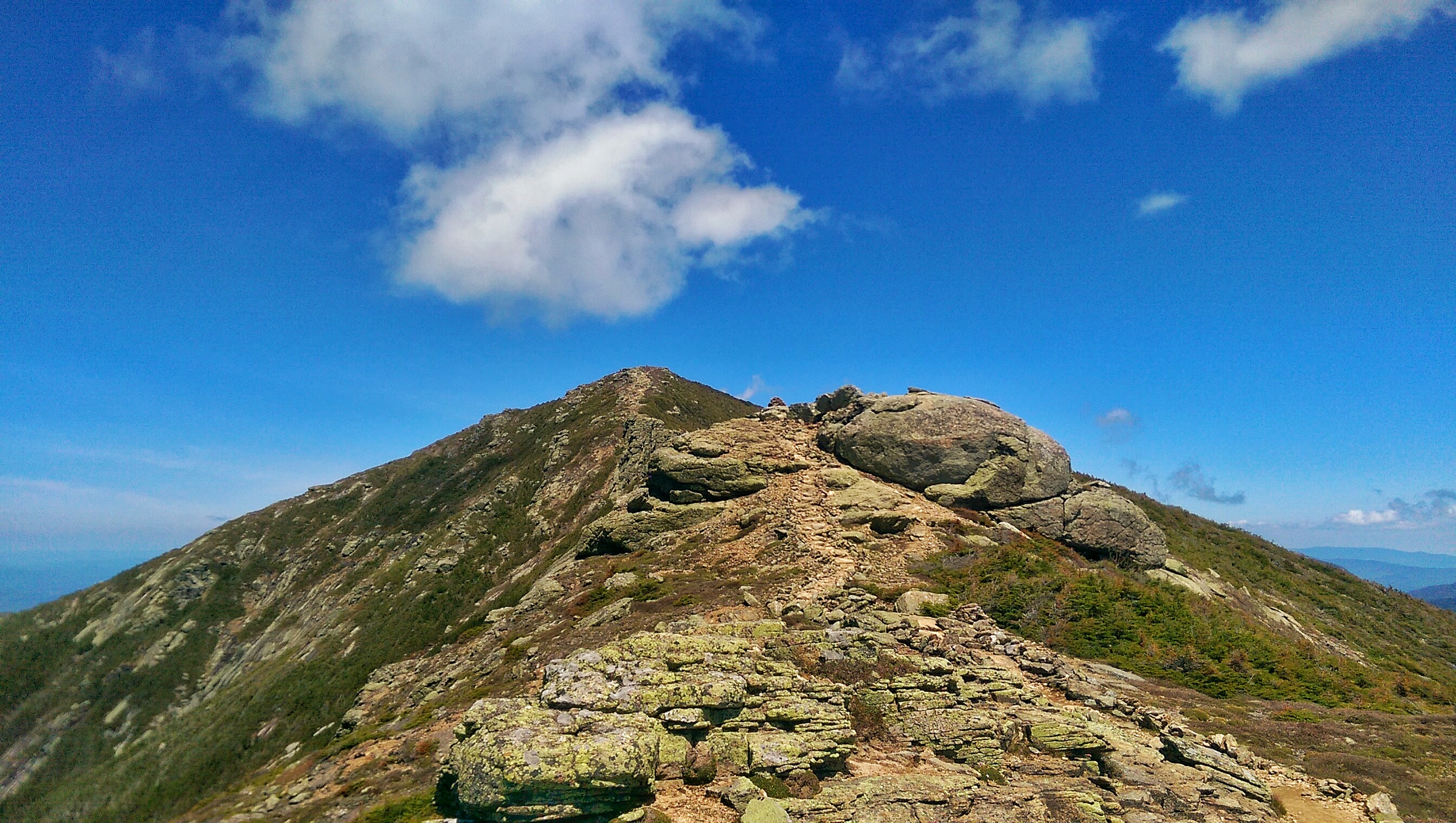
We got over the first bump and started heading up what we assumed was the next mountain, only to get to the top and see the two real mountain tops of in the distance. This was pretty discouraging, and it took us a long time to get over Lincoln Mountain (5,089′) and the biggest peak we’d face, Lafayette (5,260). After covering 2.4 miles along that brutal ridgeline, we descended below treeline to head up our last mountain of the day, Garfield (4,500′) and onto our campsite halfway down the other side of the mountain.

This 2.3-mile section was probably the most exhausting and mentally challenging part of the entire loop. After the false summit ordeal on the Little Haystack-Lincoln-Lafayette ridge line, we were spent. The first 2 miles of the section were a flat, slightly downward slope, and we cruised pretty decently. Then, we went straight up for the last .3 miles. It took us an hour and a half to get past that last .3. When we finally stumbled into the Garfield Ridge Campsite at around 6:00 after almost exactly 12 hours of hiking, we set up camp and immediately passed out…
Only to be woken up ten minutes later by the campsite caretaker, telling us we had set up on an overflow site only used when the main campsite was full, and we needed to move another 500 feet down the trail to the true campsite. We stumbled up to the main campsite, muttering under our breaths the whole time, and immediately returned to sleep.
At 4:30 am the next day, the alarm went off and we were up and out on the trail by 5:00. To me, that was one of the most difficult aspects of this hike. You had zero time to spare. You needed to get your miles and you needed to get them fast. We didn’t have the option to hit the snooze button a few times and then just meander down the trail for a while to get our legs warmed up. It was an absolute grind, the whole time.

-John Muir
We plowed through a relatively easy 2.6 miles to the Galehead Hut, an AMC hut right at the base of South Twin Mountain (4,902′), which was our first climb of the day. The hut was a lovely place, the place a cash-strapped college kid (I spent my last few dollars on the parking fee) can only dream of staying in. We set off from there around 7:45, and headed straight up the side of South Twin. Straight. Up. 1,150 feet in less than a mile. A “climb straight up a rock slide for ten minutes, stop for five, rinse and repeat” type of section. By 9:30, we were on top of our seventh mountain, eating some breakfast. The rest of the day was surprisingly “easy” compared to the rest of the trip. It was an even two miles to the next trail junction, where we dropped our packs and did an extra .2 mile trip to the top of Mount Guyot (4,580′), went back and grabbed our packs and continued 1.3 miles to the top of Mount Bond (4,698′). From there it was 1.2 miles above treeline to the top of Bondcliff Mountain (4,265′), our final mountain top of the trip. We snagged some pictures on the famous overhang, had a quick lunch, and prepped to head down.

With only 9.1 downhill miles between us and the car, we figured we’d be there in a couple of hours. We started down at 1:30 headed straight down. The time we covered the first five or so miles of this last section, our feet, and mental state were slowly being destroyed. It was very challenging to just keep going, but like I said, the Pemi Loop offers no other choice. You have to get those miles done, no other option. We made it back to the car at 5:30, exhausted and incredibly satisfied, and immediately cruised to Subway and destroyed some sandwiches.

The thing I think about a lot while I’m out on trips like this, is how am I going to describe this adequately? How can I put these images into someone else’s head, to get them to understand what I saw? Pictures will never do it, no matter how hard they try. I can’t tell you what it’s like to unzip a tent flap and see a sunrise with a hundred colors, with the clouds moving through the valley below you. There’s no way someone will understand what it’s like to be sitting on top of a mountain, eating oatmeal for breakfast and watching the trees below move with the wind, knowing that chances are nobody you know will ever be where you are. I wish there was a way to transmit a live feed of exactly what I’m seeing out to everybody else…
The wild places in America are getting fewer and further between, but there still are plenty out there. I encourage everybody to get there. That doesn’t mean a thirty mile Pemi Loop, necessarily. But seek out the wild places, and get the good tidings, energy, vibes, whatever you want to call it, that they can provide. For now, I’m going to plan out my next adventure. Let me know if you have any suggestions! Thanks, guys.
Full album of photos: http://imgur.com/gallery/pEmcF
Stats: 31.4 miles, 2 days, 24 hours of hiking, 10 mountains all over 4,000 feet, 9,000 feet in total elevation gain.

Nice work Tyler! I agree it is difficult to convey what one sees, senses and experiences during these types of adventures. Pictures and words never do it justice. Keep up the good work.
Kris aka Superman :>)
LikeLike
Hahaa I’m glad you appreciate the difficulty! Thanks!
LikeLike
Hey, if you get out west, go to Custer State Park in South Dakota, also Yellowstone/Grand Tetons in Wyoming, Zion in Utah and of course, the Grand Canyon!
LikeLike
All those were already on my list, except for Custer. I’ll have to check that one out! I’ll be sure to hit all those once I get out west! Thank you!
LikeLike
Good information. Lucky me I discovered your blog by accident (stumbleupon). I’ve saved it for later!
LikeLike